ZIP Code List with Coordinates
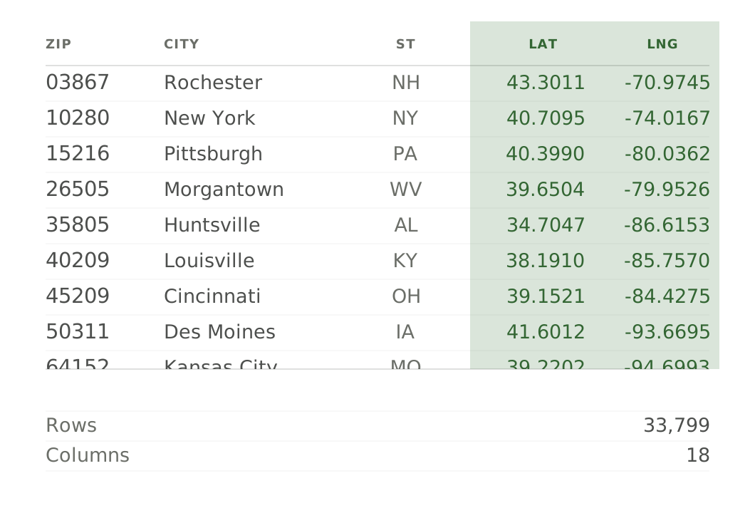
Every U.S. ZIP code placed on the map — population-weighted center point, geohash levels 1–8, and the FIPS place and county codes that join cleanly to the City and County lists.
Why teams buy the list instead of building one
Three reasons teams buy a dataset instead of building one.
Straight from the federal record
Every column traces to an official source — the U.S. Census Bureau, HUD, and the Department of the Interior. Compiled and cleaned, not scraped. Delivered as a spreadsheet the moment you check out.
A single-seat commercial license
Use it in personal, business, and commercial projects — no subscription, no recurring fees, no user limits, and no attribution required. Buy once; use it whenever.
Clean, and built to join
Consistent place names and FIPS keys mean it opens in Excel, Google Sheets, or any database and drops straight into your data. The City, County, and ZIP lists share those keys, so they join to each other too.
Every column in the file, typed and documented. Want to start building before you buy? Download a 100-row sample — the real database with real values, free to integrate against.
| CSV column | Type | What it represents |
|---|---|---|
| zip_code | text | 5-digit USPS ZIP code — this file's key. One row per ZIP. |
| primary_city | text | The city/place this ZIP rolls up to (its USPS preferred city matched to a Census place). Blank for ZIPs whose USPS preferred city has no matching Census place (~1 in 4) — never zero. |
| fips_place_code | text | Standard place code for primary_city — the public join key to the City products. Blank when primary_city is blank. |
| primary_county | text | The ZIP's primary (largest-residential-share) county; a ZIP can span several — this is the main one. |
| county_fips | text | 5-digit FIPS code for primary_county — the public join key to the County products. Blank when primary_county is blank. |
| state_code | text | USPS two-letter state or territory code. Always present. |
| state_name | text | Full state or territory name. |
| lat | number | The ZIP's population-weighted center point (latitude) from HUD — ideal for maps and 'nearby' searches, not exact boundaries. |
| lng | number | The ZIP's population-weighted center point (longitude). Pair with lat for map placement and 'nearby' searches. |
| geohash_1 | text | Geohash of the ZIP's center point at 1-character precision (broadest). Shorter prefixes group ZIPs into broader regions; longer prefixes give finer cells. |
| geohash_2 | text | Geohash of the ZIP's center point at 2-character precision. |
| geohash_3 | text | Geohash of the ZIP's center point at 3-character precision. |
| geohash_4 | text | Geohash of the ZIP's center point at 4-character precision. |
| geohash_5 | text | Geohash of the ZIP's center point at 5-character precision. |
| geohash_6 | text | Geohash of the ZIP's center point at 6-character precision. |
| geohash_7 | text | Geohash of the ZIP's center point at 7-character precision. |
| geohash_8 | text | Geohash of the ZIP's center point at 8-character precision (finest). |
A UTF-8 CSV inside a .zip. It opens in Excel, Google Sheets, databases, BI tools, and any programming language.
Every dataset ships under a single-seat commercial license — use it in personal, business, and commercial projects. No subscriptions or user limits.
Annually, as the underlying federal releases publish. Your purchase is the current vintage at download time.
An instant, secure download link, valid for 30 days. No account required.
Because the data is delivered instantly as a download, sales are final. If a file is corrupt or incorrect, email us and we'll make it right.
Put every U.S. ZIP code
on the map.
33,799 zip codes with the columns you need — one clean spreadsheet. $29 one-time, instant download, single-seat commercial license.